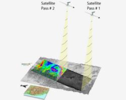
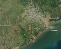
University of Houston researchers, Andrew Stearns and Julia Wellner, unravel sediment dynamics post-Hurricane Harvey, revealing human modifications' impact on sediment movement, providing crucial insights for urban flood management strategies.
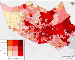
Researchers at Harris County Resilience and Infrastructure (HuRRI) develop a tool to proactively assess COVID-19 risk and vulnerability in communities, aiding policymakers in targeted resource allocation for effective response.
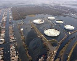
In the face of environmental threats, Dr. Rifai's group navigates the perilous intersection of hydrodynamics, infrastructure failure, and pollution, unveiling a world where industrial mishaps threaten communities and ecosystems.