Project Summary
This research examines the sinking of coastal skyscrapers on Miami’s barrier islands, identifying urban development as a primary driver of land subsidence. A team from the University of Houston’s Department of Civil and Environmental Engineering, led by Assistant Professor Pietro Milillo, used advanced satellite-based remote sensing to analyze ground movement in the region from 2016 to 2023.
Methods
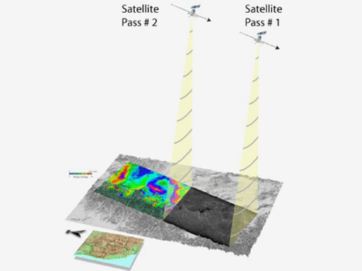
By leveraging InSAR (Interferometric Synthetic Aperture Radar), a highly precise satellite technology capable of detecting surface changes as small as a credit card’s thickness, researchers confirmed that 35 high-rise buildings have sunk by up to eight centimeters. Their findings, published in Earth and Space Science, suggest that subsidence is largely linked to the weight and vibrations from recent high-rise construction, with newer buildings showing the highest rates of initial sinking.
Goals
This study highlights the impact of rapid urbanization on coastal stability, providing crucial insights for city planners and engineers working to mitigate the risks associated with land subsidence in vulnerable coastal areas.