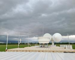
A year-long study in Houston is investigating how tiny airborne particles—like soot, dust, and smoke—affect thunderstorms. The findings could lead to more accurate predictions and a deeper understanding of how aerosols shape our weather and climate.
UH researchers have uncovered a key flaw in hurricane models that weakens intensity forecasts. By refining turbulence diffusion parameters, their breakthrough improves hurricane intensity predictions by 40% and flood forecasts by 34%, helping coastal communities better prepare for extreme storms.
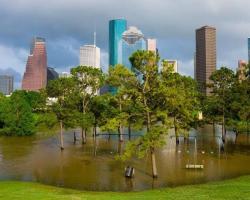
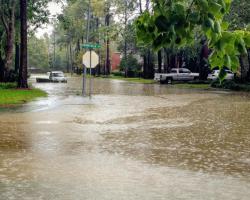
In the aftermath of Hurricane Harvey, Professor Hyongki Lee leads a transformative flood forecasting project, aiming to integrate cloud-free inundation extents with existing models, enhancing the nation's preparedness for future floods.
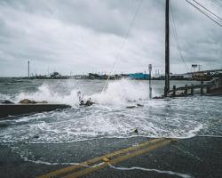
With a $675,000 NASA grant, a collaboration between the University of Houston and UC Irvine pioneers advanced methods to assess sandy beach and dune flood risks.
Following Hurricane Harvey's colossal rainfall, Prof. Will Sager and team delve into Galveston Bay, employing surveys and sediment samples to unravel sedimentation patterns, offering insights crucial for coastal resilience planning.
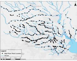
Researchers in HuRRI have developed a new model for high resolution mapping of flooded areas in Houston during Harvey using elevation information generated with Light Detection and Ranging (LiDAR) and recorded High Water Marks (HWMs)